
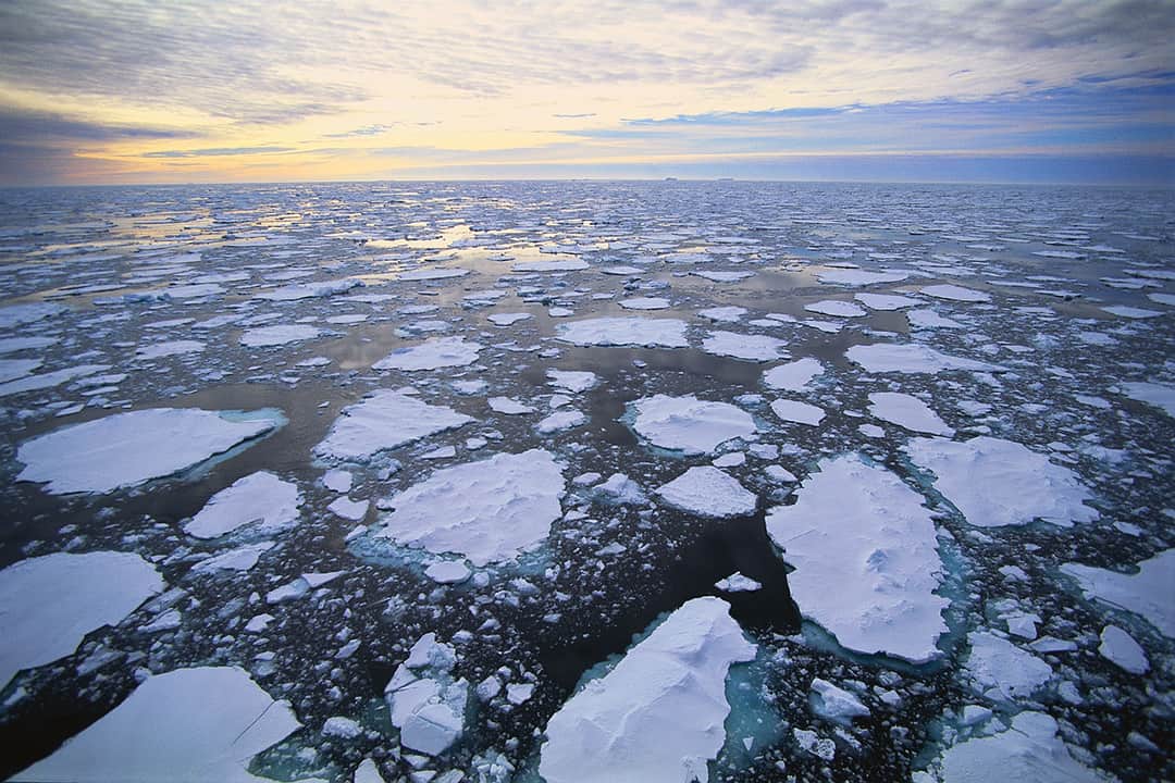
It comes in the form of snowflakes, frost, cubes, hail, “cicles,” glaciers, bergs, and even the polar caps. It is as complex as being a component of global climate and as simple as keeping our drinks cool in summer.
Ice.
Nebraskans and other Great Plains dwellers can’t escape it in the winter, and sometimes it can go beyond an annoyance on a car’s windshield to being the cause of a flash flood in an ice-clogged river.
A History of Ice
Using ice to refrigerate and preserve food goes back to prehistoric times. Through the ages, seasonal harvesting of ice was regularly practiced by most ancient cultures, including the Romans, Chinese, Hebrews, and Greeks. Ice was stored in caves lined with straw or other insulating materials.
As early as 400 BC, Persian engineers had mastered the technique of storing ice in the middle of summer in the desert. Ice was brought in during the winter from nearby mountains in bulk amounts and stored in specially designed, naturally cooled pits. These were large underground spaces that had thick walls made of a special mortar, composed of sand, clay, egg whites, lime, goat hair, and ash in specific proportions, which the Persians knew was resistant to heat transfer. The ice was then used to chill treats for royalty in the summer months.
But mainly, ice was used to preserve food over warm periods. Insulated structures were built to house ice during the summer months across the United States. Many of these icehouses remained in use into the 20th century.
During the first half of the 19th century, ice harvesting became big business in the US. A New Englander named Frederic Tudor became known as the “Ice King” after he developed better insulation methods for the long-distance shipment of ice, especially to the tropics.
Early refrigerators were known as iceboxes because they had a block of ice in them. In many cities it was not unusual to have regular ice delivery service during the summer.
Ice also has long been valued as a means of cooling the air. Until recently, in fact, the Hungarian Parliament building used ice harvested in the winter for air conditioning in the summer.
But as useful as ice can be, sometimes it can also spell trouble.
What Are Ice Jams?
Ice jams are similar to clogged drains. When winter temperatures rise and river ice begins to melt and break apart, these pieces float downstream, where they may congregate at a narrow portion of the river, near river bends, mouths of tributaries, points where the river slope decreases, downstream of dams, and upstream of bridges or obstructions. The ice-chunk “clog” causes water to back up behind it, which can then cause flooding. If the clog breaks up quickly, it can cause flash flooding in front of it as the backed-up water is released.
Ice jams in the US result in three types of situations:
- No flood threat but environmental impacts are possible.
- Freeze-up jams or freezing of mid-season breakup jams that cause chronic flooding problems for the remainder of the winter season.
- Breakup ice jams that cause sudden or flash floods.
Flow surges from a breakup ice jam can cause flash floods that move as fast as 22.4 mph. Water levels can rise rapidly, allowing little time for emergency measures. Moreover, the velocity of water and floating ice can also be very high, more than 11.2 mph, with the potential for serious erosion or ice impact damages. Individuals living close to rivers and streams are most at risk of flooding from ice jams.
How Do Ice Jams Occur?
The first ice to appear on a river is usually border ice, formed next to the riverbank. As freezing temperatures continue, sheet ice, a smooth, continuous ice cover, forms.
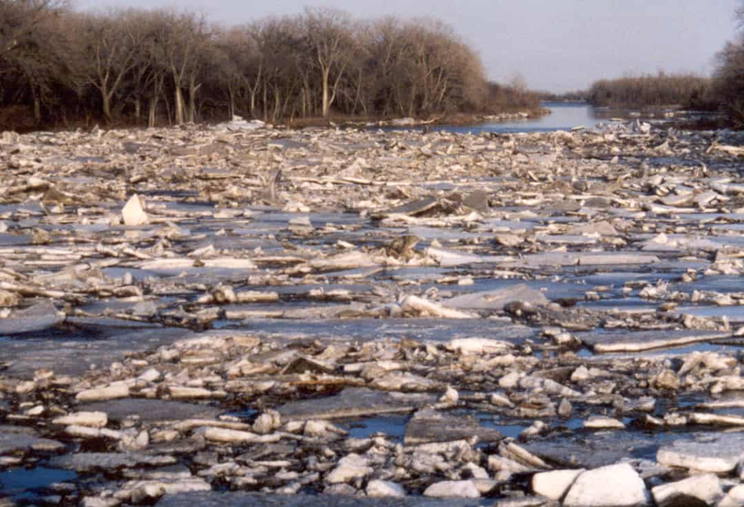
The approach of spring or a mid-winter thaw can affect ice. Warmer temperatures, heavy rains, and snowmelt increase the flow of water under frozen rivers, causing them to swell. This swelling pushes up on the ice sheet covering the river and causes it to crack and break apart. Large chunks of ice will then float downstream with the current and pile up near narrow passages or bridges, forming an ice jam.
Authorities often attempt to break up ice jams to control the flow of water that has backed up behind them. Cranes with wrecking balls and explosives are often used to break up jams.
Ice jams form during both the freeze-up and breakup periods but usually breakup jams have the greater flooding potential.
A Few Helpful Ice Term Definitions
Anchor Ice: Submerged ice attached or anchored to the river bed.
Border Ice: Ice formed along and fastened to the shore. Border ice does not extend across the entire width of a river.
Breakup Jam: Accumulation of broken ice pieces that restrict the flow of water.
Frazil Ice: Fine, small needle-like structures or thin, flat, circular plates of ice suspended in water. Frazil ice forms in turbulent water under super-cooled conditions.
Freeze-Up Jam: Accumulation of frazil ice that restricts the flow of water. May contain some broken border-ice pieces.
Sheet Ice: A smooth, continuous ice cover formed by freezing.

Breakup Jams versus Freeze-Up Jams
Breakup jams are made up of an accumulation of broken ice pieces that restrict the flow of water. Freeze-up jams are caused by accumulations of frazil ice that restrict the flow of water. Because of their high flow, breakup jams are thicker, rougher, and cause much higher water levels than freeze-up jams. Moreover, breakup jams tend to release abruptly, producing violent surges of ice and water. Erosion, damage to structures, and dislocation of aquatic life can result.
Breakup jams can occur any time after ice cover formation but are most common in February and March.
They can form more than once per season. They form and progress quickly. They are highly unstable with sudden failures and surges. Midwinter jams may freeze in place, causing additional problems later in the season.
When Are Ice Jams Most Likely to Occur?
An ice jam can occur anytime from early winter to late spring, depending on changes in temperature that cause alternate freezing and melting of water surfaces. The most likely times are early winter before the surfaces are completely frozen and early spring when the ice cover begins to break up due to melting. Three days with a maximum temperature of about 50 degrees will create enough melting to cause ice breakup on small streams. That amount of warming would also melt two inches of snow.
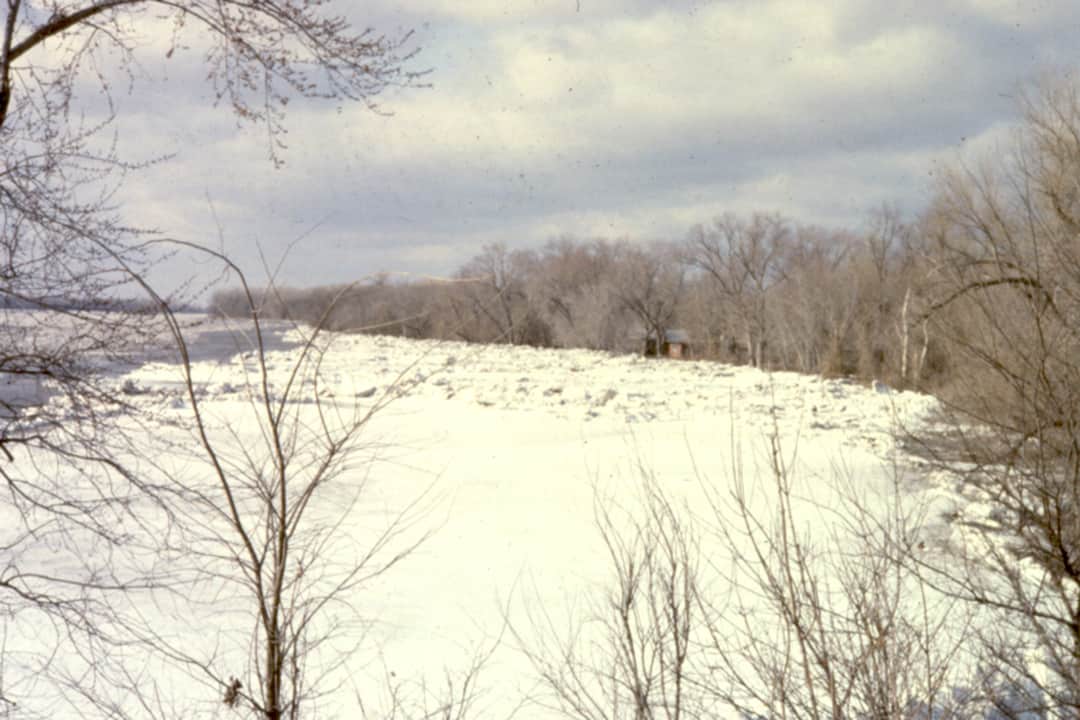
History of Ice Jam Flooding in Nebraska
Nebraska has a history of ice jam flooding going back to 1881. Since then, people have died, towns have been flooded, bridges have been washed out, dikes have been breached, and livestock has been lost.
Here is a brief synopsis of significant ice jam floods and their consequences in Nebraska:
- March 1881 on the Big Blue River at Beatrice: A combination of ice jams and rain led to many bridges being lost.
- March 1881 on the Missouri River near Cedar County and Green Island: Millions of dollars in damages, three deaths, thousands of livestock lost, ice jams four feet thick, water release swept away towns.
- February 1948 on the Loup River at Columbus: Two ice jams occurred in one month.
- March 1949 on the Missouri River at Nebraska City: An ice jam caused a record gauge height of 25.8 feet.
- March 1951 on the Elkhorn River at West Point: One death from an ice jam and snowmelt.
- March 1960 on the Platte River near Valley and Cedar Creek: One death, Union Dike was breached, 400 evacuated, 60-year flood.
- March 1962 on the Elkhorn River at West Point: One death, 10 blocks flooded, 300 evacuated, a highway bridge washed out.
- March 1962 on the Platte River at Columbus: 40 to 50 blocks flooded.
- March 1962 on the Platte River near Valley and Fremont: Union Dike breached and 90 percent of the towns flooded.
- February 1966 on the Elkhorn River at Norfolk: 200 cattle lost, 15 families evacuated.
Recent Ice Jams
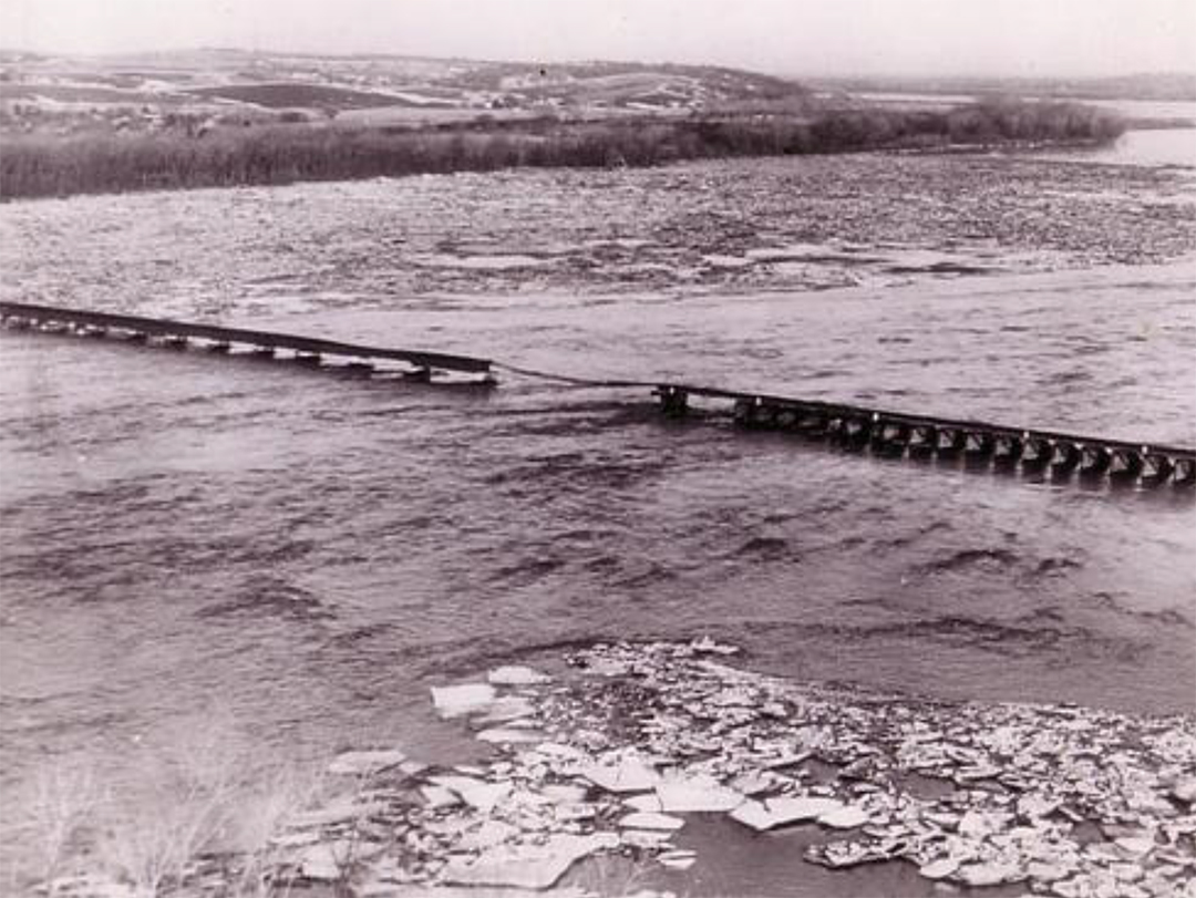
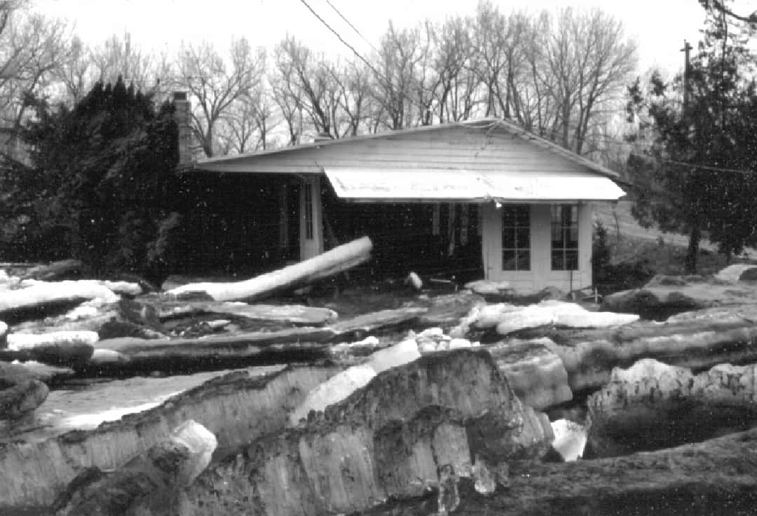
1978 — During the spring of 1978, the Platte River in eastern Nebraska was continuously plagued by ice jams building up and then releasing. As portions of the ice, estimated to be up to 24 inches thick, were beginning to break loose in areas farther upstream, a 0.60-inch rain on frozen ground, followed quickly by an inch of snow that immediately melted, soon spelled disaster for the city of Valley.
One of the main jams that occurred that year was located about two miles south of Valley. As more and more ice backed up, the water had nowhere to go except over and out. Another jam, estimated to be over a mile long, was located north of Valley. The entire area between Ashland to the south and North Bend to the north was under a severe flood warning. There was one death reported, gauges were washed out, and the flooding was declared a 25-year event.
One explosives technician described the 1978 ice jams as “spectacular” because they were the worst he had seen in 25 years on the Platte.
Teams of flyers helped by tossing 25-pound bags of dynamite from helicopters to create holes and loosen up the jams. Within two days, they had dropped up to 30,000 pounds of explosives on the Platte. Damage estimates caused by flooding in the spring of 1978 exceeded $240 million.
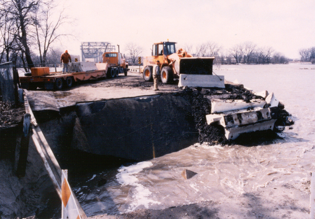
1997 — Ice jams occurred along the Platte and Elkhorn Rivers and Bell Creek during February 18 to 23, 1997. There was extensive flooding of farmland and at least one farmstead along Bell Creek due to a half-mile-long ice jam about three miles north of Highway 30 near Arlington. Elkhorn Crossing Recreation Area was almost entirely under water. Floodwaters were pouring over the Western Sarpy Dike in the half-mile reach upstream of Highway 64. Homes in Thomas Lakes, located in a low area south of the dike, were flooded. Emergency Disaster Declarations were issued by Sarpy, Cass, and Saunders Counties and the Papio-Missouri River Natural Resources District. Explosive charges were dropped alternately both upstream and downstream of Highway 6. A Nebraska Department of Roads crane and wrecking ball were also employed in the effort. A break in the sand dike south of Plattview Road added to the flooded area in western Sarpy County.
1998 — Flooding occurred from March 16 to 18, 1998, along the Platte and Elkhorn Rivers. Two ice jams on the Platte caused river stages to run within two feet of overtopping the Woodcliff roadway-dike in Saunders County. Stages were running one to three feet high along the Union Dike in Dodge County. Explosive charges were used near Vencils Island and the Union Dike-Woodcliff area. A total of 228 charges were dropped. Water levels fell immediately.
2001 — Between March 13 and 17, 2001, areas of Nebraska on the Platte and Elkhorn rivers were again hit hard with major flooding when ice jams occurred in several locations. Ice thicknesses on the Platte averaged 20 inches on March 7. An explosives contractor was retained to clear a small ice jam on the Elkhorn near Winslow. More than 100 residents were evacuated because of rising water and flooded homes. Water levels in Ashland exceeded normal levels by about six feet, and land was flooded for about 6.5 miles along the river between Yutan and Valley. Excessive flooding was due to temperatures rapidly rising into the 60s, which caused snow to melt and ice to break up and jam, producing large amounts of backwater flooding.
2009 — In January 2009, an ice bridge that dammed the Missouri upstream of Ponca for several days caused a nearly five-foot drop in the river’s elevation and had Nebraska and Iowa water managers worried. The falling river created water supply troubles at Sioux City, Iowa, and threatened Omaha and Nebraska City public water supply intakes. The US Army Corps of Engineers had released water from the main system of reservoirs on December 9 and again on December 15 in anticipation of just such an event. But despite these increased releases, the ice bridge still caused river levels to drop about four feet at Omaha and Nebraska City. The ice blockages moved downstream with the current and river levels came back to normal.
In February, warm weather caused ice to melt and break apart on the Platte River near Linoma Beach in Sarpy County. The ice was causing jams along both the Platte and Elkhorn Rivers. Linoma Beach residents were asked to evacuate. Thankfully, the jam broke and water began to recede, causing deputies to call off the evacuation. In addition, a portion of Highway 275 along the Dodge and Cuming county lines was closed due to an ice jam on the Elkhorn near West Point.
2015 — An emergency was declared along the Platte River as flooding from a mile-long ice jam threatened homes, buildings, and Lincoln and Omaha water pipelines. The ice jam also triggered flooding that sent campers in search of high ground in Two Rivers State Recreation Area, between Yutan and Omaha. Rescuers pulled at least three people and a dog from a truck caught in the water near the recreation area.
How Can We Protect Against Ice Jams?
All too often in the northern US, floodplain management and hazard mitigation plans do not account for the increased flooding associated with ice jams, even though ice-induced floods can occur as quickly as rain-induced flash floods.
Ice jams on small rivers can cause serious flooding in a community, but damages are often too small to justify conventional flood-control measures such as dams and levees. Environmental concerns can also make these options unattractive.
Ice engineering is a growing new field that is attempting to provide technical analyses, methods, and engineering solutions to ice problems. The US Army Corps of Engineers’ Cold Regions Research and Engineering Lab has developed two low-cost structures to control ice jams on small rivers. These structures are also designed to minimize environmental impact. The technology can be used on most rivers that do not support commercial navigation.
Breakup jam prediction methods that can be used to increase response time are desirable to minimize flood damage, including potential loss of life. A variety of hydrologic and hydraulic models exist to predict open-water flooding, whether resulting from rainfall, snowmelt, or catastrophic events such as dam breaches. However, breakup ice jams result from a complex series of physical processes that cannot currently be described with analytical models. This hinders development of accurate prediction methods, which can make designing flood protection extremely difficult.
In Nebraska, a number of agencies, including the Nebraska Emergency Management Agency, the Department of Natural Resources, local Natural Resource Districts, and the US Army Corp of Engineers in Omaha, monitor ice jam conditions along the state’s major rivers and streams at key locations. Monitors generate weekly reports during the months from December to March, which can be viewed at http://dnrdata.dnr.ne.gov/Icejam/index.asp.
Ice Facts
- Pagophagia, a type of eating disorder, is the compulsive consumption of ice.
- During World War II, Project Habbakuk was a British program that investigated the use of wood fibers mixed with ice as a possible material for warships, especially aircraft carriers, due to the ease with which a large deck could be constructed. The idea was given up when there were not enough funds for construction of a prototype.
- Ice can be used to start a fire by carving it into a lens that focuses sunlight onto kindling. When one waits long enough, a fire will start.
- Ice jams are a major cause of flooding in Finland and Canada. In fact, for most Canadian rivers, the annual peak water levels are due to ice jams, and the most sudden rises in water levels in Finnish rivers are due to ice jams.
- In climate change, ice plays an important part because it reflects 90 percent of the sun’s rays. Furthermore, ice cores help provide important paleoclimate information.
- In January and February 1658, the straits between the islands of Denmark, Great Belt, and Little Belt froze over, allowing a Swedish army to march across the Belts and defeat the Danish army. The resulting Treaty of Roskilde ceded large areas of Denmark to Sweden.
- Ice has been used as the material for a variety of musical instruments.
References
Environment Canada.
Gaarder, Nancy and Leta Baez. “Breakup of Ice Jam Ends Linoma Beach Evacuation.” Omaha World-Herald, February 10, 2009.
Hendee, David. “Ice Bridge Can Spell Trouble for River.” Omaha World-Herald, January 12, 2009.
International Red River Basin Task Force (Canada).
Kroczynski, Scott. “Ice Jams Can Cause Floods.” National Weather Service, August 23, 2005.
Laukaitis, Algis J. and Riley Johnson. “Platte River Ice Jam Strands Campers, Causes Flooding Near Two Rivers SRA.” Lincoln Journal Star, 2015.
Lincoln Journal Star.
Marquette County, Michigan.
McMaster, Steve. Historical information and photos. Nebraska Department of Natural Resources.
Northeast States Emergency Consortium.
Penry, Jerry. Historical information. Milford, Nebraska.
Petermann, Marlin. Historical information. Papio-Missouri River Natural Resources District.
Szalewski, Susan. “Flooding Is Minor: Residents Urged to Remain Vigilant.” Omaha World-Herald, February 10, 2009.
US Army Corps of Engineers.
US Army ERDC Cold Regions Research & Engineering Lab.
White, K. D. et al. “Ice Jam Flood Risk Reduction Strategies.” Geophysical Research Abstracts, 2006.
White, K. D. “Review of Prediction Methods for Breakup Ice Jams.” Canadian Journal of Civil Engineering, February 2003.
www.environment.fi.